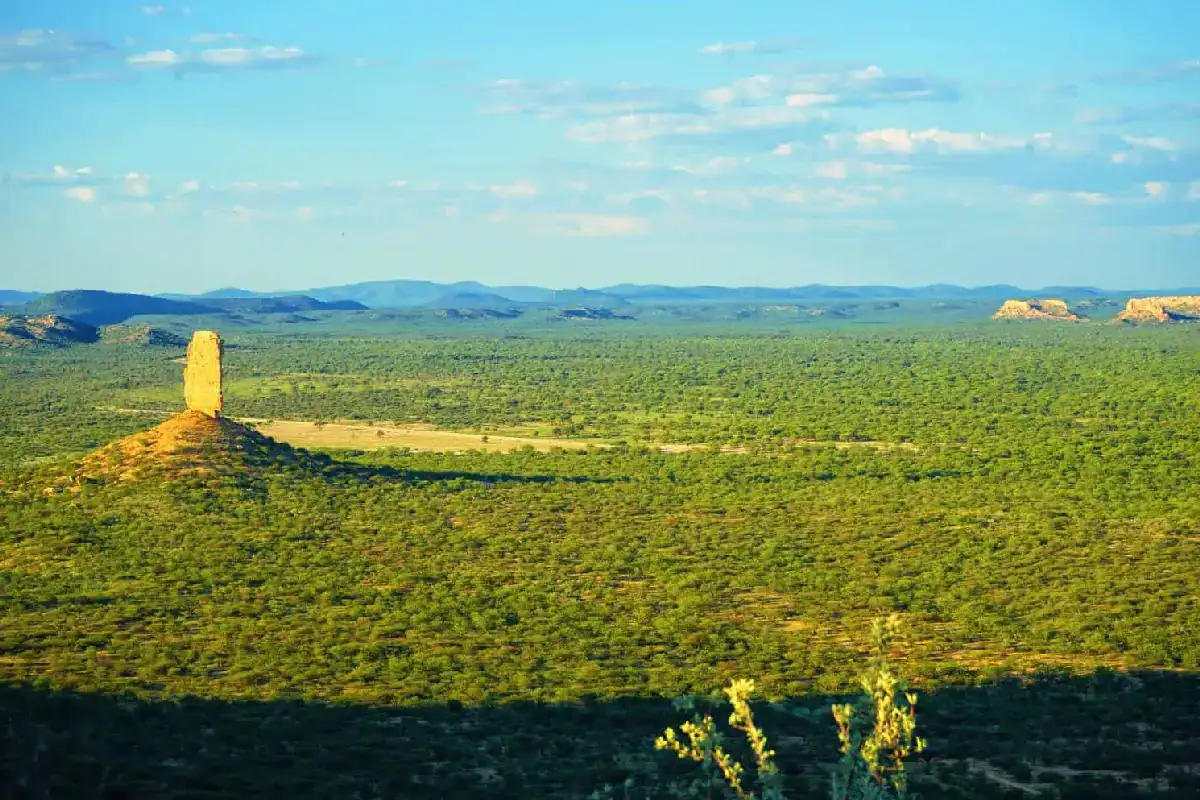
The Vingerklip in Namibia is a unique rock structure which rises from a hilltop in the Ugab Valley — a slender, 35-metre column standing completely alone against the open sky. The striking Vingerklip rock formation is set within one of Damaraland’s most dramatic landscapes, where flat-topped mesas and terraces stretch as far as the eye can see.
What is the Vingerklip in Namibia?
Namibia’s Vingerklip is a solitary rock needle and one of the most distinctive rock formations in southern Africa. It stands in the Ugab Valley region of Damaraland.
Approximately 15 metres wide with a circumference of 44 metres at its base, it sits at an elevation of 929 metres above sea level. It consists of carbonated sandstone and conglomerate — bound together by lime acting as natural cement. The Vingerklip has been Namibia’s most famous rock finger since the collapse of the Mukurob in 1988.
What Does Vingerklip Mean?
Vingerklip is an Afrikaans word meaning “finger stone” or “rock finger” — a name that perfectly describes the formation’s appearance. Extraordinarily slender relative to its height, it resembles a giant stone finger pointing skyward from the summit of its hill. The name is entirely self-explanatory to anyone who sees it — and it is one of those rare geological formations whose Afrikaans name is more evocative than any translation.
The Geology: Ugab Terraces and Millions of Years of Erosion
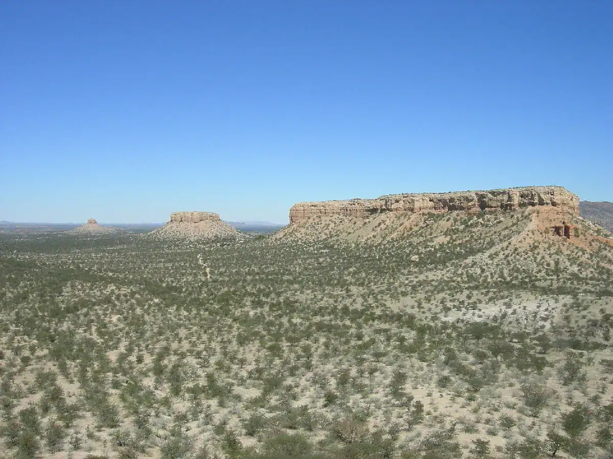
The Ugab Terraces that line Namibia’s Ugab Valley began forming around 66 million years ago, as the Ugab River cut deep valleys into the ancient Damara mountains. Between 14 and 20 million years ago, erosion slowed and the valley filled with sand and gravel, hardening into conglomerate. A new phase of erosion beginning roughly 2 million years ago carved that conglomerate back down into the terraces seen today — and, at the Vingerklip, down to a single narrow column.
The Mukurob: Namibia Once Had Two Rock Fingers
Until 1988, Namibia had two famous rock fingers. The Mukurob in southern Namibia — meaning “Finger of God” in the Nama language — stood near Asab. At 12 metres high and weighing approximately 450 tons, it balanced on a base just 1.5 metres wide and 3 metres long. On the night of 7 December 1988, it collapsed — the result of erosion, a heavy rainstorm and seismic vibrations from a 6.9 magnitude earthquake in Armenia that registered as far away as Windhoek. Since that night, the Vingerklip has stood as Namibia’s last remaining rock finger.
Can You Visit the Vingerklip in Namibia?
Yes — day visitors are welcome to visit the Vingerklip seven days a week. The formation is located on the private property of Vingerklip Lodge along the D2743. A small entrance fee is paid at the lodge reception which is open daily from 07:00 to 20:00. The hike to the Vingerklip is self-guided — simply set off on the marked trail once you’ve paid. No advance booking is needed.
The walk from reception to the base of the Vingerklip is approximately 1.8 kilometres, taking around 45 to 60 minutes return. The trail is largely flat and easy across the valley floor, with a short but steep climb of loose shale in the final section. Sturdy footwear is recommended. At the base, a low rope barrier prevents visitors from climbing or defacing the finger rock. For those with more time, extension and terrace hikes of 2 to 3.5 hours are also available. Climbing the Vingerklip itself is strictly prohibited.
Where to Stay Near the Vingerklip
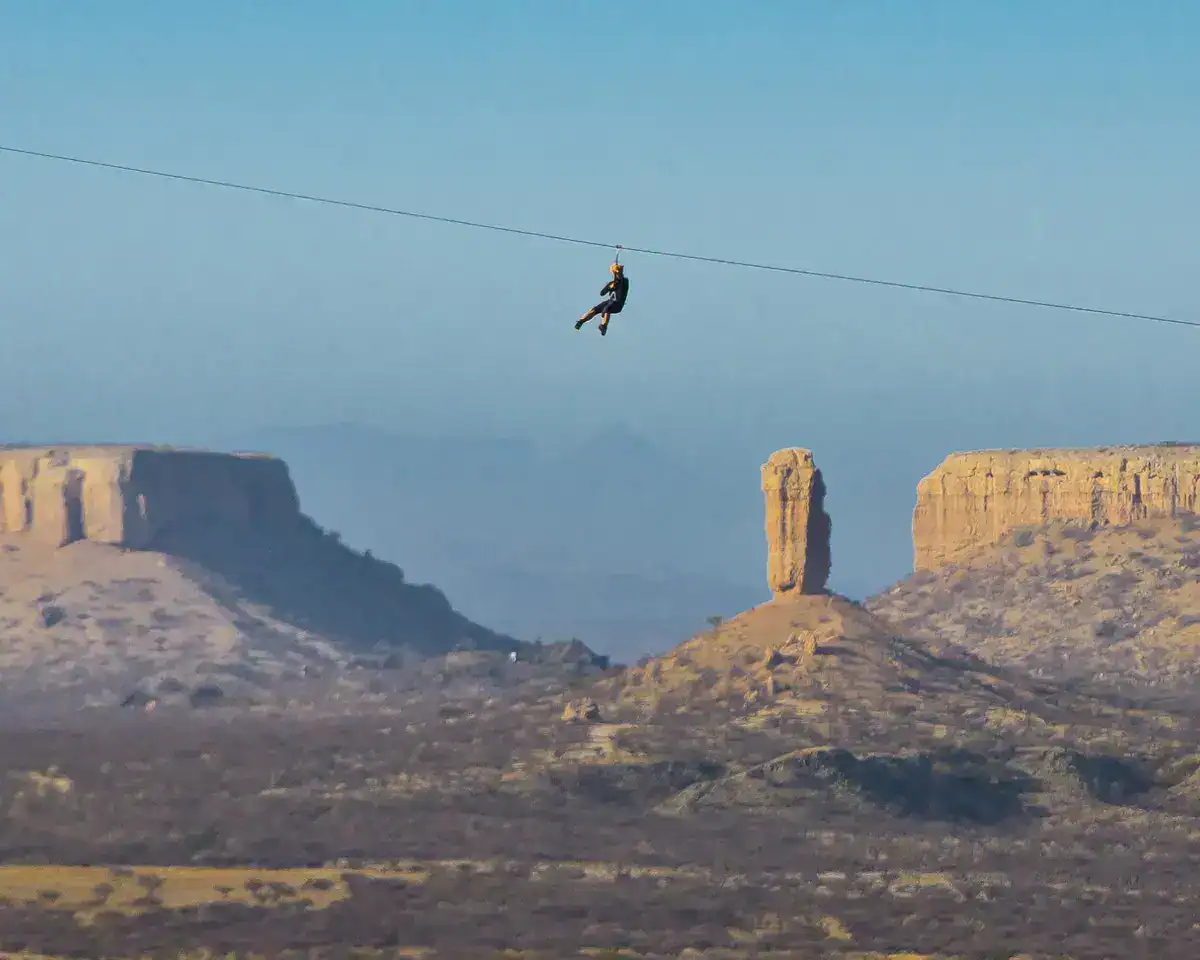
Ugab Terrace Lodge is located just 7.5 km from the Vingerklip — an ideal base for exploring the Vingerklip in Damaraland and the wider Ugab Terraces landscape. The lodge also offers the longest zip line in Namibia — a memorable add-on for adventurous travellers and families.
For a full overview of Damaraland accommodation near Vingerklip, see our dedicated accommodation guide.
Getting To the Vingerklip
The Vingerklip in Namibia is found on the D2743, a gravel road branching south off the C39 between Outjo and Khorixas. From Outjo, follow the C39 westwards and turn left onto the D2743 — follow the signs for Vingerklip. From Khorixas, follow the C39 eastwards and turn right onto the D2743. The Vingerklip Lodge reception is approximately 20 km along the D2743.
Important: The Vingerklip is not visible from the C39. If you stay on the tarred road, you will miss it entirely — look out for the D2743 turnoff sign.
- From Outjo: approximately 102 km — 1 hour 12 minutes via C39
- From Khorixas: approximately 72 km — 55 minutes via C39 and D2743
What Else to Visit Near the Vingerklip
The Vingerklip in Damaraland combines well with other attractions as part of a broader road trip through the region.
The Petrified Forest geological site is approximately 116 km west along the C39 — approximately 1 hour 32 minutes from the Vingerklip.
Twyfelfontein petroglyphs site in Damaraland is approximately 169 km west, approximately 2 hours 22 minutes via C39.
For travellers heading to or from Etosha National Park, Andersson Gate is approximately 195 km from the Vingerklip via Outjo — approximately 2 hours by road.
Frequently Asked Questions
What is the Vingerklip in Namibia?
The Vingerklip is a 35-metre finger rock rising from the summit of a hill in the Ugab Valley of Damaraland, Namibia. It consists of carbonated sandstone and conglomerate, sculpted into its distinctive shape through millions of years of erosion by the Ugab River. Since the collapse of the Mukurob in 1988, it has been the country's most famous rock finger.
What Does Vingerklip Mean?
Vingerklip is an Afrikaans word meaning "finger stone" or "rock finger" — a name that perfectly describes the formation's appearance. It is entirely self-explanatory to anyone who sees it for the first time.
How tall is the Vingerklip?
The Vingerklip is 35 metres tall, approximately 15 metres wide, with a circumference of 44 metres at its base. It sits at an elevation of 929 metres above sea level.
How old is the Vingerklip?
The exact age of the Vingerklip is difficult to determine precisely. The deposits that form it date from the Tertiary period — approximately 10 to 20 million years ago — while the distinctive finger shape was sculpted by the Ugab River over the last 2 million years.
Can you climb the Vingerklip?
No — climbing the Vingerklip is strictly prohibited. Visitors are welcome to hike to the base of the finger rock, which takes approximately 45 to 60 minutes return from the Vingerklip Lodge reception. The Vingerklip was first climbed in 1970 by American mountaineer Tom Choate — the hooks from his ascent are still visible on the rock today.
Where is the vingerklip located in Namibia?
The Vingerklip is located in the Ugab Valley in Damaraland, north-western Namibia — approximately 80 km southwest of Outjo and 50 km east of Khorixas. It is accessed via the D2743, a gravel road branching south off the C39.